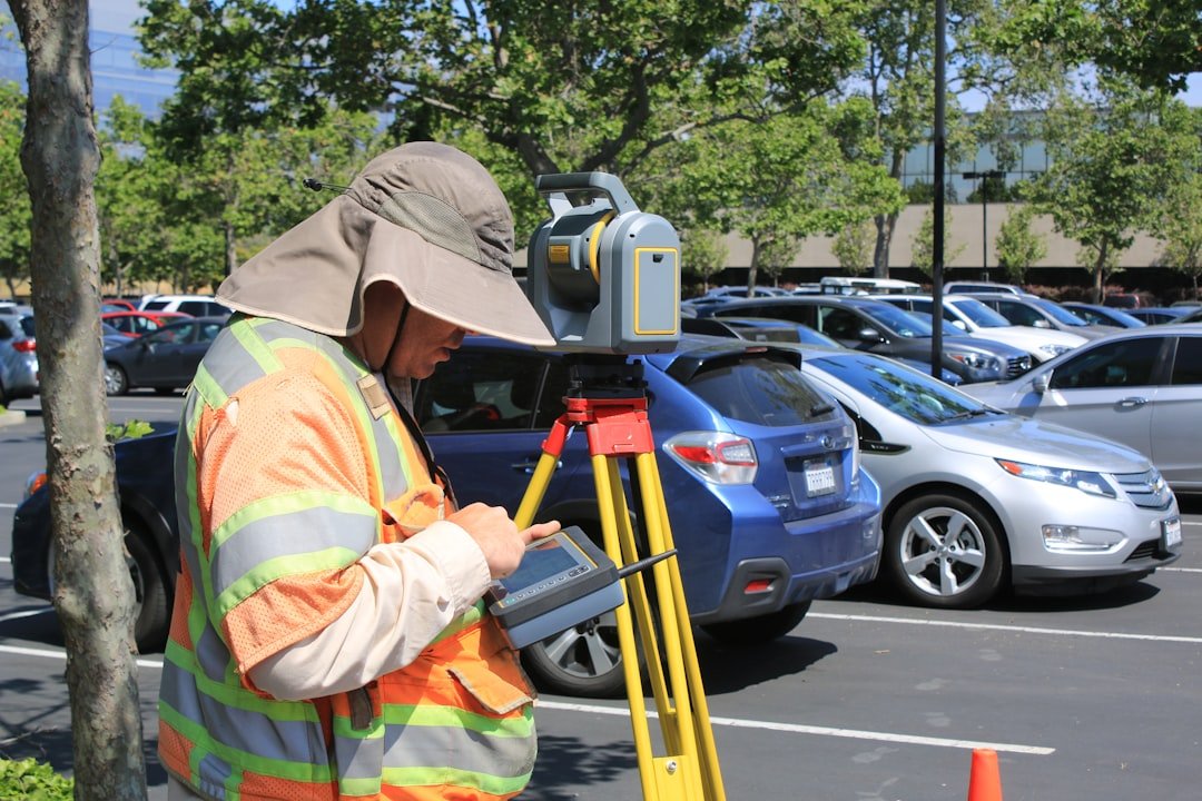
Land surveying is a critical discipline that involves measuring and mapping the land’s surface to determine property boundaries, topography, and other essential features. At its core, land surveying combines elements of science, engineering, and mathematics to create accurate representations of land parcels. Surveyors utilize a variety of tools and techniques, including theodolites, total stations, GPS technology, and drones, to gather precise data about the land.
This information is then used to produce detailed maps and legal documents that define property lines and inform land use decisions. The practice of land surveying dates back thousands of years, with ancient civilizations employing rudimentary methods to delineate land ownership and manage resources. Today, land surveying has evolved into a highly specialized field that requires extensive training and certification.
Surveyors must possess a deep understanding of local laws, regulations, and geographic information systems (GIS) to effectively perform their duties. The profession is governed by strict ethical standards, ensuring that surveyors provide accurate and unbiased information to their clients.
The Role of Land Surveying in Real Estate Transactions
In the realm of real estate transactions, land surveying plays an indispensable role in establishing clear property boundaries. When a property is bought or sold, a survey is often conducted to confirm the exact dimensions and location of the land in question. This process helps prevent disputes between neighboring property owners regarding boundary lines, easements, and encroachments.
A well-executed survey provides potential buyers with peace of mind, knowing that they are acquiring a property with clearly defined limits. Moreover, land surveys are essential for determining the value of a property. Accurate measurements and detailed maps can significantly influence a property’s marketability and price.
For instance, if a survey reveals that a parcel of land is larger than previously thought, it may increase its value in the eyes of potential buyers. Conversely, if a survey uncovers encroachments or boundary disputes, it could lead to complications that may diminish the property’s appeal. Thus, having a reliable survey is crucial for both buyers and sellers in navigating the complexities of real estate transactions.
The Importance of Land Surveying in Property Development

Land surveying is a foundational element in property development projects. Before any construction can begin, developers must understand the topography, soil conditions, and existing infrastructure of the site. Surveys provide critical data that informs design decisions, ensuring that buildings are constructed in suitable locations and that drainage systems function effectively.
For example, a topographic survey can reveal slopes and elevations that may impact water runoff and landscaping choices. Additionally, land surveys help developers comply with zoning regulations and building codes. Local governments often require surveys to assess whether proposed developments align with existing land use plans.
By providing accurate information about property boundaries and site conditions, surveys facilitate the permitting process and help developers avoid costly delays. In essence, thorough surveying lays the groundwork for successful property development by ensuring that projects are feasible and compliant with legal requirements.
Land Surveying in Infrastructure Projects
Infrastructure projects such as roads, bridges, and utilities rely heavily on precise land surveying to ensure successful execution. These large-scale projects require comprehensive surveys to assess existing conditions and plan for future developments. For instance, when constructing a new highway, surveyors must evaluate the terrain, identify potential obstacles, and determine the best alignment for the road.
This information is crucial for minimizing environmental impact and optimizing construction costs. Furthermore, land surveying plays a vital role in utility installation projects. Whether it involves laying down water pipes or electrical lines, accurate surveys are necessary to avoid conflicts with existing infrastructure and natural features.
Surveyors must map out the locations of underground utilities to prevent damage during construction. In this context, land surveying not only aids in planning but also enhances safety by reducing the risk of accidents related to unmarked or misidentified utilities.
Ensuring Legal Compliance through Land Surveying
Legal compliance is a paramount concern in land ownership and development, making land surveying an essential tool for ensuring adherence to laws and regulations. Property boundaries must be clearly defined to avoid disputes that could lead to litigation. A professional survey provides an official record of property lines that can be referenced in legal matters.
This documentation is particularly important when dealing with issues such as easements or rights-of-way that may affect neighboring properties. Moreover, many jurisdictions require surveys as part of the permitting process for new construction or significant renovations. These surveys help local authorities verify that proposed projects comply with zoning laws and building codes.
By providing accurate data on property boundaries and site conditions, surveys facilitate informed decision-making by regulatory bodies. This compliance not only protects developers from potential legal challenges but also ensures that community standards are upheld.
The Impact of Technology on Land Surveying

Enhanced Data Collection
GPS technology enables surveyors to pinpoint locations with remarkable precision, while laser scanning provides detailed three-dimensional models of terrain and structures. These tools have greatly improved the accuracy and speed of data collection, enabling surveyors to make more informed decisions.
The Role of Drones in Land Surveying
Drones have emerged as a game-changer in the field of land surveying. Equipped with high-resolution cameras and LiDAR sensors, drones can quickly capture vast areas of land from above, producing detailed aerial maps that were once time-consuming to create using ground-based methods. This technology not only speeds up the surveying process but also reduces costs associated with labor-intensive fieldwork.
Future Developments and Improvements
As these technologies continue to evolve, they are likely to further enhance the accuracy and efficiency of land surveying practices. The integration of new technologies and methods will likely lead to even more innovative solutions, transforming the field of land surveying and enabling surveyors to work more efficiently and effectively.
Conclusion and Outlook
In conclusion, the advancements in technology have revolutionized the field of land surveying, and it is expected that these technologies will continue to improve, leading to more accurate and efficient surveying practices.
Choosing the Right Land Surveying Company
Selecting an appropriate land surveying company is crucial for ensuring accurate results and successful project outcomes. When evaluating potential firms, clients should consider several factors including experience, reputation, and specialization. A company with a proven track record in specific types of surveys—such as boundary surveys or topographic surveys—will likely have the expertise needed for a particular project.
Additionally, it is essential to verify that the surveying company employs licensed professionals who adhere to industry standards and ethical practices. Clients should request references or case studies from previous projects to gauge the firm’s reliability and quality of work. Open communication is also vital; a good surveying company will be willing to discuss methodologies, timelines, and costs upfront to ensure transparency throughout the process.
The Future of Land Surveying: Trends and Innovations
As technology continues to advance at a rapid pace, the future of land surveying is poised for significant transformation. One notable trend is the increasing integration of artificial intelligence (AI) into surveying practices. AI algorithms can analyze vast amounts of data collected during surveys to identify patterns and generate insights that enhance decision-making processes.
This capability could lead to more efficient project planning and execution. Another innovation on the horizon is the use of augmented reality (AR) in land surveying. AR technology can overlay digital information onto physical landscapes, allowing surveyors to visualize data in real-time as they conduct fieldwork.
This immersive approach could improve accuracy by providing immediate feedback on measurements and site conditions. Furthermore, sustainability is becoming an integral consideration in land surveying practices. As environmental concerns grow, surveyors are increasingly tasked with assessing ecological impacts during development projects.
This shift necessitates a more holistic approach to surveying that incorporates environmental considerations alongside traditional measurements. In conclusion, the field of land surveying is evolving rapidly due to technological advancements and changing societal needs. As surveyors adapt to these trends and innovations, they will continue to play a vital role in shaping our built environment while ensuring compliance with legal standards and promoting sustainable practices.